|
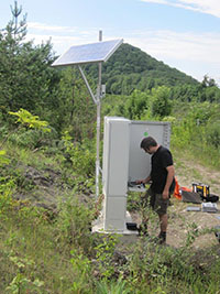
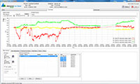
For the configuration and operation of complex geosensor-networks as weel as data acquisition and visualization we closely cooperate with our partner AlpGeorisk, the developer and provider of the "AlpGeorisk-online" software package. The data acquisition units installed on-site transmit the stored raw data at regular intervals (for instance every 24 h) via FTP to a web server. The data is immediately checked for plausibility by the software and - if necessary - further processing steps, such as conversion of raw data (for instance 4-20 mA current) into correctly dimensioned units (e.g. water pressure, deformation, etc.). Both the collected raw data and the processed values are then stored in a SQL database that allows an immediate online access to the data.The "AlpGeorisk" software provides further functions for passive (verifying incoming data) and active (direct control and status data acquisition units and infrastructure elements) status monitoring of the entire geosensor-network so that system failures can be quickly detected and diagnosed. With the help of flexible thresholds (single values, value combinations, trends, etc.) and the customizable status and alarm services, the system alerts immediately via SMS or email if any unusual readings and system states occur. For data visualization, the AlpGeorisk "Viewer" software is used by the project partners. It allows visualization of the data in customizable time series diagrams and online accesses to the SQL database. |


